Traveling independently is one of the most rewarding experiences you can have. It offers freedom, flexibility, and a chance to explore the world at your own pace. However, traveling solo or independently comes with its unique challenges, one of which is navigation. Knowing where you are, where you’re headed, and how to get there safely is paramount. In today’s tech-driven age, the best maps and navigation tools for independent travel have made it easier than ever to explore new places confidently. Whether you are wandering through bustling cities, hiking remote trails, or driving across countries, having reliable navigation aids can make a significant difference in your travel experience.
In this article, we’ll dive deep into some of the best maps and navigation tools for independent travel. We’ll explore everything from offline map apps to GPS devices, and from crowd-sourced platforms to classic paper maps. By the end, you’ll have a well-rounded toolkit to help you find your way wherever your adventures take you. Let’s get started.
Why Having the Best Maps and Navigation Tools Matters

Imagine landing in a new city or a remote village with no sense of direction and no reliable way to find your hotel or the nearest convenience store. That scenario can quickly turn a fun trip into a stressful one. The reality is, even the best travel plans can falter when you don’t have good navigation tools. This is where technology steps in to help us explore with more confidence.
Independent travel often requires flexibility in routes, especially when public transport can be unpredictable, or you want to deviate from common tourist paths. The best maps and navigation tools for independent travel enable you to do just that. They help you discover hidden gems, avoid getting lost, and even improve your safety by guiding you away from unsafe areas.
There are many options, each tailored to different needs. Some work well for road trips, others excel for backpacking, and some blend many features such as real-time traffic updates and user-generated reviews. Having at least one reliable navigation tool on your device—and a backup plan—makes all the difference.
Top Mobile Apps for Independent Travel Navigation
Smartphones have revolutionized how we navigate. There are dozens of apps boasting various features, but some stand out as the best maps and navigation tools for independent travel. The main advantages of mobile apps are their accessibility, frequent updates, and user-friendly interfaces. Many come with offline mode, which is crucial when traveling to areas with limited internet access.
1. Google Maps
Google Maps is arguably the most recognized navigation app worldwide. It offers detailed maps of nearly every country, real-time traffic updates, public transit routes, walking directions, and driving navigation. One of the strongest points of Google Maps is its integration with Google’s vast ecosystem and frequent updates.
Pros of Google Maps:
- Offline map downloads for selected areas
- Street View for virtual previews
- Integration with businesses, showing reviews and photos
- Real-time traffic and transit updates
Cons:
- Offline maps are limited in size and officially must be renewed every 30 days
- Requires occasional internet for full functionality
2. Maps.me
For travelers who visit places with poor internet connectivity, Maps.me is a godsend. Its biggest selling point is the ability to download entire countries’ maps and use them completely offline. This app is community-driven, using OpenStreetMap data, which means it’s updated regularly by users worldwide.
Key features of Maps.me:
- 100% offline usage, including walking, driving, and cycling routes
- Bookmark favorite places for easy access
- Detailed points of interest (POIs) including restaurants, ATMs, and tourist sites
3. Komoot
If your independent travels lean toward outdoor adventures like hiking, mountain biking, or trekking, Komoot is one of the best maps and navigation tools for independent travel. It specializes in route planning for outdoor activities with detailed trail maps.
Highlights of Komoot:
- Topographic maps showing terrain details
- Turn-by-turn voice navigation for outdoor trails
- Community recommendations for trails and routes
4. Waze
Waze is an excellent choice if you’re driving, especially in countries where traffic congestion is a concern. Unlike static maps, Waze uses user-generated data to provide up-to-the-minute traffic information, road hazards, and speed traps.
Why Waze stands out:
- Real-time traffic alerts and route recalculations
- Crowd-sourced data for road incidents and hazards
- Integration with music and other apps for a seamless experience
Traditional Versus Digital Maps: When Paper Still Matters
While apps are fantastic, they aren’t foolproof. Battery life issues, lack of internet, or technical glitches can leave you stranded. So, carrying a paper map or two is a wise choice, particularly if you’re venturing into remote or wilderness areas.
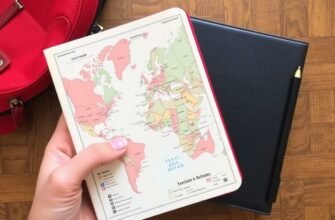
Benefits of Carrying Paper Maps
Paper maps don’t rely on electricity or mobile signals. They offer a broad overview, helping you understand the geography better and plan alternate routes if needed. You can mark your own routes, note points of interest, or use them to backup your digital navigation tools.
Some travelers find that having a paper map enhances the experience, making the journey feel more tangible and adventurous. Many national parks, rural regions, and hiking trails provide detailed paper maps that can be invaluable.
Types of Paper Maps Worth Carrying
| Map Type | Best For | Where to Get |
|---|---|---|
| Road Maps | Road trips, navigating highways and cities | Gas stations, tourist information centers |
| Topographic Maps | Hiking, trekking, outdoor adventures | National park offices, outdoor shops |
| City Maps | Urban exploration, locating landmarks and attractions | Tourist info centers, hotels |
Specialized GPS Devices for Independent Travel
Although smartphones dominate navigation, specialized GPS devices still hold an essential place, especially for travelers who push the limits of outdoor exploration. These devices are rugged, weather-resistant, and often have longer battery lives than phones.
Garmin GPS Devices
Garmin is one of the leading brands for handheld GPS devices. They offer models designed for hikers, bikers, and even marine travelers. The advantage of these devices is precision and reliability. They can operate for days on a single charge or replaceable batteries.
Key Garmin features include:
- Preloaded maps with topographical and road details
- Ability to download additional maps based on region
- ABC sensors (Altimeter, Barometer, Compass) for outdoor data
- Integration with smartphone apps for synchronizing trails and routes
Dedicated Navigation for Vehicles
For those on road trips who prefer not to use their phone, dedicated automotive GPS navigation devices like Garmin Drive or TomTom offer clear, reliable routing without the distractions of other phone apps. They usually provide real-time traffic updates through connected services or built-in LTE in some modern devices.
Unexpected Utilities of Crowd-Sourced and Social Navigation Tools
One of the most interesting trends in the best maps and navigation tools for independent travel is using crowd-sourced platforms. These tools rely on users themselves to provide data, making them rich in local insights and up-to-date information.
Examples of Crowd-Sourced Navigation Apps
- Waze: For drivers, as discussed earlier, Waze excels due to live reports from users about accidents, police presence, or road closures.
- OsmAnd: This app uses OpenStreetMap data and allows travelers to contribute corrections and new data, leading to very detailed and accurate maps especially for off-the-beaten-path locations.
- TripAdvisor and Google Reviews: While not navigation apps per se, these platforms help travelers figure out where to go based on community reviews, integrating well with map apps.
How to Choose the Best Maps and Navigation Tools for Your Independent Travel
Choosing the right navigation toolkit depends largely on your travel style, destination, and activities planned. Here’s a handy checklist to help you decide:
| Travel Style / Activity | Recommended Navigation Tool(s) |
|---|---|
| City Exploring / Urban Trips | Google Maps, City Paper Maps |
| Road Trips | Google Maps, Waze, Dedicated GPS Devices |
| Hiking / Outdoor Adventures | Komoot, Garmin GPS, Topographic Paper Maps, OsmAnd |
| Remote Areas / Limited Internet | Maps.me, Paper Maps, Garmin GPS |
| Budget Travel | Free Apps with Offline Capabilities (Maps.me, OsmAnd) |
Additional tips include always having a backup navigation source, carrying spare power banks for your devices, and taking time to familiarize yourself with map reading basics for times when technology fails.
Integrating Navigation Tools with Travel Planning

Great navigation tools don’t just help during the trip—they are invaluable in the planning stage too. For example, Google Maps can help you estimate travel times, explore alternative routes, and see places of interest in advance. Apps like Komoot let you plan detailed outdoor excursions, then export those routes to your phone or GPS device.
Sharing your planned routes with friends or family adds a safety layer. Some GPS devices and apps allow live location sharing, which is a smart feature to use, especially when traveling alone in unfamiliar places.
Safety Considerations When Relying on Navigation Tools
It’s essential to remember that no tool is perfect. Even the best maps and navigation tools for independent travel should be used with caution. Always double-check your surroundings, stay alert, and trust your instincts. Remember these tips:
- Keep your devices charged and carry extra batteries or power banks.
- Download offline maps before leaving Wi-Fi zones.
- Have an emergency plan and know key local contacts.
- Use updated and reliable apps and devices.
- Carry a physical paper map where applicable.
- Stay aware of local safety advisories and avoid risky routes.
Conclusion
Navigating the world independently is a wonderful adventure, and having the best maps and navigation tools for independent travel can elevate the entire experience, turning potential stress into confidence and discovery. From versatile mobile apps like Google Maps and Maps.me to specialized GPS devices and trusty paper maps, there are options to suit every type of traveler and destination. By thoughtfully combining digital, traditional, and crowd-sourced tools, and matching them to your style and needs, you can explore new places with ease and safety. Remember, preparation is key. Equip yourself well, stay flexible, and enjoy the incredible freedom that independent travel offers. With the right maps and navigation tools, the world truly becomes your playground. Safe travels!